Chaco Canyon Vortex
-
Vortex Type: Ancient
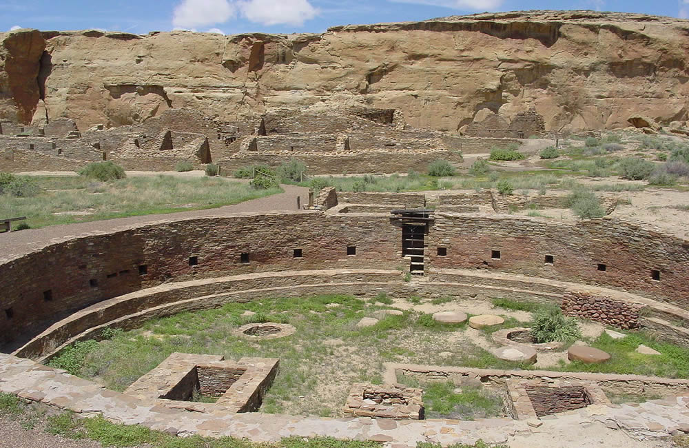
Between AD 900 and 1150, Chaco Canyon was a major center of culture for the Ancient Pueblo Peoples. Chacoans quarried sandstone blocks and hauled timber from great distances, assembling fifteen major complexes that remained the largest buildings in North America until the 19th century.
-
Evidence of archaeoastronomy at Chaco has been proposed, with the "Sun Dagger" petroglyph at Fajada Butte a popular example. Many Chacoan buildings may have been aligned to capture the solar and lunar cycles, requiring generations of astronomical observations and centuries of skillfully coordinated construction.
Climate change is thought to have led to the emigration of Chacoans and the eventual abandonment of the canyon, beginning with a fifty-year drought commencing in 1130.
Chaco Canyon lies within the San Juan Basin, atop the vast Colorado Plateau, surrounded by the Chuska Mountains to the west, the San Juan Mountains to the north, and the San Pedro Mountains to the east.
Ancient Chacoans drew upon dense forests of oak, piñon, ponderosa pine, and juniper to obtain timber and other resources. The canyon itself, located within lowlands circumscribed by dune fields, ridges, and mountains, is aligned along a roughly northwest-to-southeast axis and is rimmed by flat massifs known as mesas.
Large gaps between the southwestern cliff faces—side canyons known as rincons—were critical in funneling rain-bearing storms into the canyon and boosting local precipitation levels.
The principal Chacoan complexes, such as Pueblo Bonito, Nuevo Alto, and Kin Kletso, have elevations of 6,200 to 6,440 feet (1,890 to 1,960 m). The alluvial canyon floor slopes downward to the northwest at a gentle grade of 30 feet (9.1 m) per mile (6 meters per kilometer); it is bisected by the Chaco Wash, an arroyo that rarely bears water. The canyon's main aquifers were too deep to be of use to ancient Chacoans: only several smaller and shallower sources supported the small springs that sustained them. Today, aside from occasional storm runoff coursing through arroyos, substantial surface water—springs, pools, wells—is virtually nonexistent. - wikipedia
Chaco Canyon Vortex Links and Articles
Image By National Park Service (United States) [Public domain], via Wikimedia Commons
The Center of an Ancient World
Chaco Canyon National Historical Park, Photo Galleries
Chaco Culture National Historical Park
Chaco Canyon, New Mexico Prehistoric Roadways
Healing Energies of New Mexico
Navajo legends of shapeshifters in Chaco
Note: There is currently no scientific method to prove that vortexes exist. Just because a location is on the vortex map, does not prove there is a vortex there. What it means, is that someone suggested the location and provided evidence or a personal account, and/or we found corroborating evidence from other sources. We do this so other visitors to the site can send us their opinion on the validity of the vortex claim, to build a consensus.
Have you visited this location? If so, contact us and let us know if you think this place is a vortex or not. We will post your comments here.